Capt. Greg Thornton has been delivering yachts for more than 10 years. Along the way, he’s encountered virtually every type of electronic navigation equipment, which is why he keeps the Navionics app on a tablet in his gear bag. “You’re jumping on a boat blindly, and rather than having to get a specific map or program, Navionics caters to that diversity,” said Thornton.
Recently, he had to move a 100-foot Swan sailing yacht from Sint Maarten to Rybovich Marina in West Palm Beach, Florida. The radar was the only functioning technology on the vessel. “If I didn’t have Navionics on my tablet, I would have been dealing with old-school navigation, looking at the Ritchie compass and having to plot,” he says.
Thornton, who is the founder of Norseman International, which offers yacht management, operator instruction and delivery services, also uses Garmin’s In-Reach satellite messenger app. And on larger yachts, if there is cellular coverage, he backs up Navionics with the Marine Traffic app that provides AIS data. Thornton also uses the Navionics online forums. Before a recent run to New Smyrna Beach, Florida, he went to the forums for updates on the area. It turned out there’d been some sand shifting and shoaling that could affect a boat with a deep draft.
There are multiple reasons why Navigation apps like Navionics and Aqua Map continue to gain in popularity. Getting up-to-date information is a major reason. Affordability is another. Instead of spending at least a few hundred dollars for a basic chartplotter, Navionics, which has been around since 2008 and is now owned by Garmin, can be installed on a tablet or smartphone for $14.99 per year. Apps like Argo and KnowWake combine navigation with socializing and provide location data to find friends who are on nearby waters. For fishing enthusiasts there are the Anglr and Fishbrain apps that help them find fish. Here’s a look at just some of the many boating-related apps out there:
Navionics
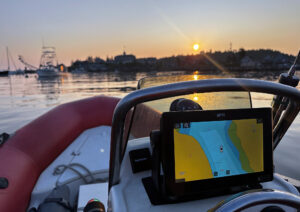
One reason for the popularity of the Navionics app is its ease of use. If you can use Google Maps, you can use this. Core features that have made it a leading app are its dock-to-dock auto routing, community-sourced SonarCharts, downloadable daily chart updates and an easy-to-use display. Navionics offers support for Active Captain crowd-sourced data and displays AIS information from an onboard AIS receiver. The SonarCharts Live feature records soundings data from your depthfinder and can display it in real time on the tablet. Your data is recorded and then shared with Navionics, which creates a SonarChart layer based on the received data and then shares it with other Navionics users.
Aqua Map
Somewhat newer than Navionics but rapidly catching on with boaters, Aqua Map displays Waterway Guide and Active Captain crowd-sourced points of interest to provide information on marinas, anchorages, hazards and navigational features. The app has an anchor alarm that facilitates monitoring your boat’s position at anchor, and U.S. and Canadian charts are available with lifetime updates.
Aqua Map master is available as a $10 per year add-on. It includes the ability to display U.S. Army Corps of Engineers (USACE) surveys overlayed onto a chart. Aqua Map’s Route Explore displays AIS and instrument data. Those who frequent the Intracoastal Waterway will appreciate Aqua Map Master’s accurate reporting of depths, areas with hazards and bridge specifications. Before a captain even gets underway, Route Explorer gives alerts for planning purposes, including hazards on the route and potential fuel stops. For the latest depth updates, Aqua Map places USACE survey data over the chart display, giving added clarity on where the deepest water can be found. The Corps of Engineers has made survey data available for years, but previously it was only available on district websites or Google Earth files. Aqua Map displays the surveys and updates them.
Knowwake and Argo
For boaters who want to find out where all the cool kids are hanging out on the water, the KnowWake and Argo apps combine navigation with social networking. They are like the on-land navigating app Waze in that they show the locations of the other members of the app. KnowWake uses Google Maps for charts and offers auto-routing. Argo Basic is free and offers real navigation and the location of friends and nearby app users. Members set up a profile that includes the boat’s draft, average speed, fuel usage and port of origin, which helps with trip planning. This summer, Argo Premium is expected to debut, which will add weather information including wind, tides, offline charts and more.
Many boaters on apps like KnowWake and Argo use them for route-planning before a cruise and then take advantage of the social networking capabilities to coordinate a rendezvous with friends in advance. They let a user plan and route a trip with point-to-point navigation and share a member’s location with friends. They display depth, no-wake zones, channel markers and up-to-date reports on the presence of marine life such as manatees, and other potential hazards. Users can also save and share trips.
Dockwa
Dockwa is the OpenTable of boating by allowing boaters to make marina reservations on their mobile device in real time, assuring them they have a place to tie up their boat before they set off on a trip. Dockwa lets boaters book slips or moorings, pay fees or plan a fueling stop. It can be used for seasonal and annual arrangements but is particularly helpful for transient boaters who need a stopover reservation.
Windy
Windy is a professional weather forecasting app that visualizes wind, waves and weather for sailors, fishermen, surfers, kite surfers, windsurfers and boaters. The app provides wind reports, forecasts and statistics. The wind map shows a wind compass, wind meter, wind gusts and wind directions.
Tropical Tidbits
If you’re worried about hurricanes or simply like to geek out on Atlantic hurricane info, you’ll want to check out Tropical Tidbits. Levi Cowan, who has a PhD in meteorology, created the app in his dorm room in 2012. Cowan provides forecast models, satellite imagery, current storm information, historical data and surface and ocean analysis tools, and produces YouTube videos and blog posts where he analyzes the hurricane information.
CBP ROAM
CBP ROAM is a free government mobile app that provides pleasure boaters the option to report their U.S. entry to Customs and Border Protection (CBP) via their personal smart phone or tablet. Last year, the app’s capabilities were expanded by allowing users to apply for cruising licenses and report arrivals at domestic ports of call. With some exceptions, it is an alternative to face-to-face inspections with a CBP officer. The captain submits the vessel details (you have to get a DTOPS sticker for U.S. returning vessels over 30 feet), the crewmembers’ data and a picture of every passport. When at or near the port of entry, the captain starts the arrival procedure by filling in the arrival and departure information. Once the info has been submitted, CBP initiates a video conference call, first with the master of the vessel, and then with each of the crew members. It eliminates the need for a customs officer to show up at the vessel or have the captain go to the CBP office to check in.
When using any app, think about the reliability of a tablet or smartphone. Most mobile devices don’t interact well with water, and they can overheat if left out in the sun. Capt. James Marshall of Reliable Yacht Deliveries likes the larger format that a tablet or laptop offers because it gives a better view of what’s going on around your boat. He uses Navionics on a laptop with a 15-inch screen to supplement the vessel’s MFD. “If I’m doing an offshore delivery, I can use the laptop to plot where I want to go,” Marshall says.
But Marshall also warns against being too reliant on the electronics and making sure that a captain is aware of what’s going on around him or her. He recalled a recent trip to Bimini when the channel was repositioned due to shoaling. Extra buoys were added and some were moved so there was something of a channel, but Marshall also watched the locals to learn where the channel actually was. “Had I just gone to where the chart was and not seen the other buoys, we probably would have run aground,” Marshall says. “We always say, ‘Get your head out of the boat. Look around at everything else that’s going on.’”
This article was originally published in the July 2022 issue.

